Mapping an education: finding perfect Vermont maps to share with students
By Victoria Hughes
Education is at the heart of our work at the Vermont Historical Society, and a goal of our school programming is to actively engage students actively as historians. We do this by using compelling primary sources, including a variety of maps that organizes large amounts of information in a visual format. Fortunately for us, the Leahy Library provides us with plenty of options to bring the perfect map into the classroom to share with students.
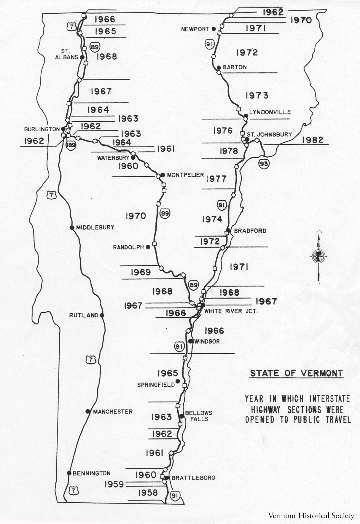
In May 2022, we held a History for Homeschoolers class (made up of in-person and virtual sessions) that focused on how the construction of the interstate highways changed Vermont. To help guide the students through that history and the impact of those new roads, we had students take a look at a variety of different maps: shows when segments of the interstate opened to the public. Students had fun searching for the oldest section (I-91, between Vernon and Guilford, which opened in 1958) and for the most recent (I-93, in Waterford, which opened in 1982), while also looking at photographs to understand why the construction process took so many years. Some of the students pointed out that that the roads destroyed parts of Vermont’s natural habitats and the faster speeds brought new dangers to people and animals alike, while others recognized the benefits that the limited-access highways brought to the state.
To challenge the students, we had them analyze a second map, one that showed a proposed route of Interstate 89 through Middlesex. The document dates back to the late 1950s, and details the relocation of Route 2 to make way for the highway along the railroad tracks and Winooski River. Near the older transportation routes, the map includes names of property owners and the outlines of buildings that stood there. The resulting discussion of eminent domain shocked the students, who considered the process as unfair: some proposed alternate solutions, like rerouting the highway around existing houses, although a few students suggested crafty ways to increase the compensation for the land owners.
One final map, a satellite map through Google Maps, helped introduce the current debate over the continuation of I-189 in Burlington’s South End, the Champlain Parkway project. The map shows how the built environment reflects changes in transportation patterns and community priorities. Now and into the future, students can help shape what Vermont – and maps of the state – will look like for generations to come.
We also use a variety of types of maps in the museum’s Hands-On History programs to encourage students to think like historians. A Beers Atlas map of Kent’s Corners in Calais helps students practice using primary sources as evidence. By locating all the properties labelled with the name “Kent,” students can make educated guesses about the origin of the place name. In a program about immigration, students uncover factors that pulled immigrants from Italy to Vermont in the early 1900s by investigating a Sanborn Fire Insurance map of Barre that highlights the size and number of granite sheds.
And in the Mapping Vermont History activity, classes create a timeline of 18 different maps to investigate changes that take place over time: they see evidence of how European cartographers erased Indigenous people from the maps, they use Vermont counties and transportation routes to help date mystery maps. All the while, they get to look carefully at primary sources and experience the excitement of examining historic documents.
By using these maps in conjunction with other resources, we’re able to help students build vital historical thinking skills. And, they can explore the state from home: many of these primary sources are available on the Vermont History Explorer website so teachers can include these maps and high quality materials in their classroom lessons.
Check out vermonthistoryexplorer.org/maps to explore these resources and more from VHS collections and other repositories.
This article originally appeared in the Summer 2022 issue of our member magazine, History Connections. To get it and support the Vermont Historical Society, sign up as a member.